
Can Science Warn of the Next One? An Expert Explains the Unanswered Questions After Nepal’s Deadly Disaster (Interview)

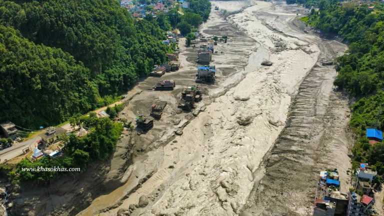
The devastating floods and cascading debris flows along Nepal’s Bhote Koshi and Trishuli river corridors have raised urgent questions about what triggered the disaster, how climate change may be altering risks in the Himalayas, and whether technology can provide communities with more time to escape future events.
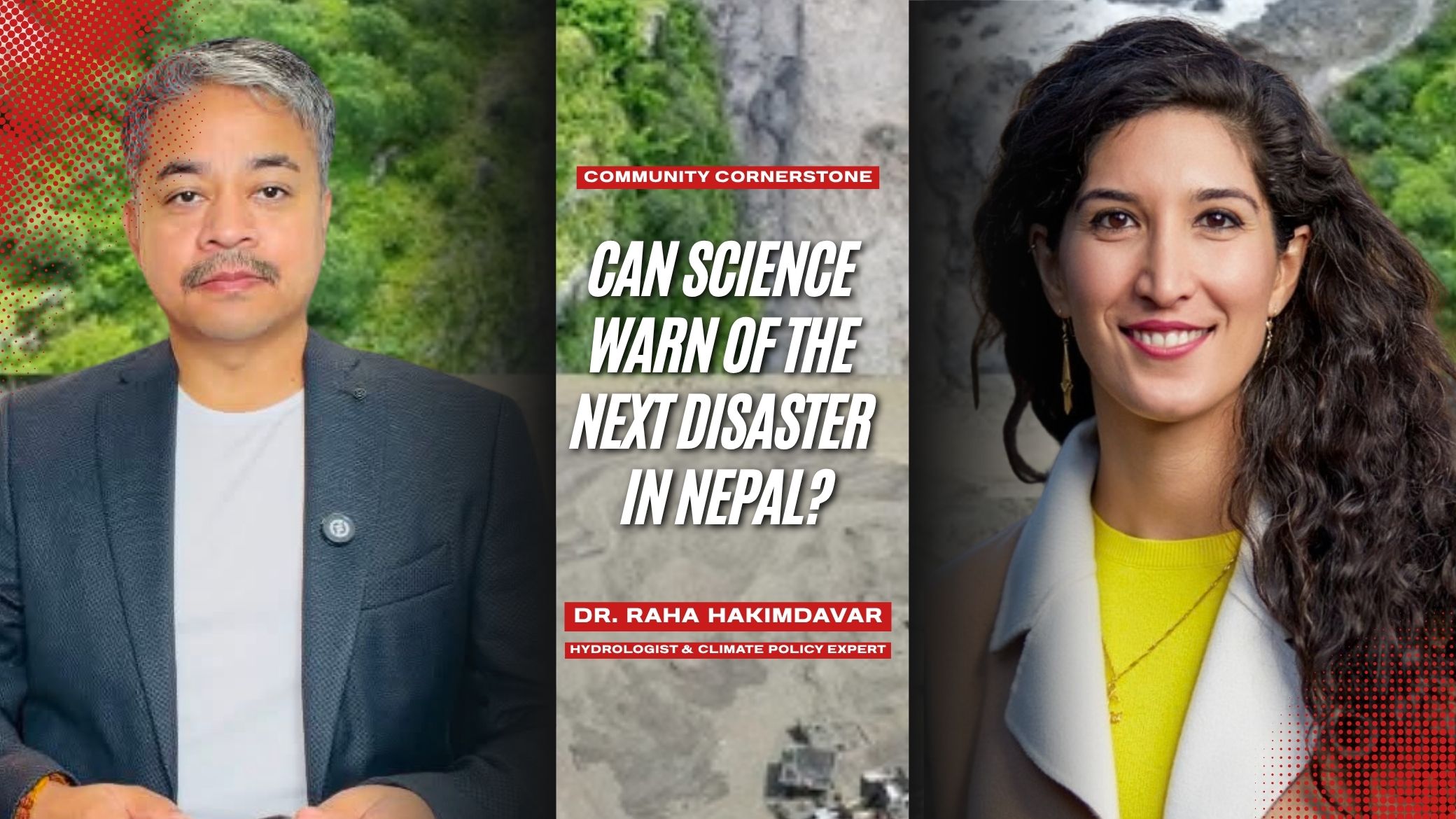
In this interview with NepYork Editor Suresh Shahi, Dr. Raha Hakimdavar, a hydrologist, climate policy expert and space science leader, discusses what scientists know — and what they are still trying to understand — about the disaster. She explains why the event does not fit neatly into the category of a glacial lake outburst flood, how satellite and ground-based observations could improve early warning systems, and why preparedness, risk assessment and community resilience must begin long before the next disaster strikes.
Suresh Shahi: Based on what we know, was this a glacial lake outburst flood, a rock-and-ice avalanche, or a combination of events? What exactly caused the disaster that killed thousands of people and left thousands missing?
Dr. Raha Hakimdavar: Yeah, exactly. When the event first happened, there was a lot of confusion. First, we actually had registered a 5.2-magnitude earthquake on USGS seismometers, and so we thought it was maybe an earthquake. Then we thought it could be a glacial lake outburst flood, which, you know, those are known in Nepal and in the region.
And then we realized, when looking at the satellite imagery before and after the events, which was extremely helpful in helping us understand, you know, really piece together what had happened and what was happening, that it was, I think, the latter point of what you said: an ice-rock avalanche, debris flow, cascading events. Not exactly a glacial fall, which I think was also reported using that language.
You can think of it in that way, but just a very, very large break that’s led to this cascading series of things, with the debris flow, with an avalanche and the flooding that happened downstream.
Suresh Shahi: Looking at the videos of the event, it is very disturbing. Is this something we can describe as a regular flood situation or a regular avalanche that happened to create such a huge disaster? What do you think caused it?
Dr. Raha Hakimdavar: I would say it was not an earthquake, not a glacial lake outburst flood. It was basically the structural integrity of the glacial ice had been compromised. And part of that, I think, now is being more closely connected to things that could come from climate change, so the warming that we’ve been observing.
But it was definitely, you know, large enough for it to be picked up as seismic activity. So this is not a normal event, absolutely not something that is easy to predict either, and that’s what made it so destructive.
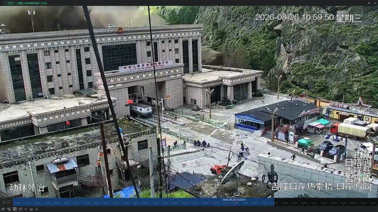
So if you actually look at the lead time from when you had this break-off of this avalanche — we can call it the rock-and-ice flow — to when the flooding happened downstream and impacted the communities catastrophically, there was just so little time to respond.
And part of that, I mean, you know, the topography of Nepal is very complex. It’s very challenging. So you have really high slopes leading to much lower elevations and short distances. But that makes this very difficult for us to predict these sorts of events.
So I would not call this a typical glacial lake outburst. We actually have quite a lot of monitoring of the large glacial lakes in Nepal. So that’s something that we have. It’s a known hazard, and actually the lead time we have for those kinds of floods is longer than what we experienced here.
So, yeah, when you see the videos, you can really see not just how quickly that water is flowing but how destructive it is because you have so much material that was, unfortunately, flowing at a very, very fast rate across the river systems and just extremely destructive and extremely difficult to respond to.
Suresh Shahi: You mentioned climate change. Nepal’s prime minister recently spoke at the United Nations about global warming and climate change. How does global warming affect glaciers, snow and mountain slopes in Nepal? And more broadly, what are the effects around the world in mountainous regions? What evidence do we have that climate change is affecting these systems?
Dr. Raha Hakimdavar: I will just say that I appreciate the comments from the prime minister at the UN General Assembly. I think it’s a really important call, and I appreciate actually something that is so personal that’s happening in the country, for him and others to be connecting that to a broader call to the world. I think that’s extremely important.
I mean, in the region we’re seeing strong warming, we’re seeing increasing melt potential and a pronounced shift from snow to rain.
So, you know, there’s a distinction there that climate change is changing the background conditions of the Himalayan cryosphere, the kind of icy parts of our Earth and the landscape in which these hazards occur.
That doesn’t necessarily mean we can attribute every individual landslide or rock-ice failure in this case directly to climate change. Actually, that’s quite challenging in general for us to attribute individual events to climate change.
What we really try to understand is the changing conditions and the longer-term pattern. And this pattern, I mean, it is, you know, we are observing higher temperatures, we are observing glacial retreats, permafrost degradation, higher freezing levels, greater snow and ice melt, and, of course, the glacial lakes are expanding and they’re changing.
So these are things that we know to be true in the region. And I think more and more the science community is coming out and really saying that, yeah, this kind of failure that happens in the structural integrity of the glacier has a lot of the underlying challenges that are coming from climate change tied to it.
Suresh Shahi: So, are you emphasizing the importance of being careful about how scientists attribute an individual event to climate change?
Dr. Raha Hakimdavar: We’re careful with science. You know, we want to be accurate in what we say, and I personally want to be mindful of also not getting ahead of what’s really being done in the science community with those who are working with the data.
So I would be careful in the way of how we frame it. But definitely, I mean, there’s a connection to climate change and what’s happening.
Suresh Shahi: Earlier, you mentioned that this was not a usual flood event but something very unusual. As scientists, are there warning signs that can be identified before an event like this happens?
Dr. Raha Hakimdavar: I think, again, an event like this is very challenging to have an early warning because, you know, can you really go and monitor every single glacier and everywhere with the detail that we need?
But what we can do with science and actually what we can do with data, and especially with satellite data that we have available to us now, is we can do kind of a hotspot analysis.
And what that means is, you know, you can monitor these larger swaths of land and we look for certain signals, certain trends, things that may be changing. And we have lots of different types of satellite instruments that can be used to detect different types of changes in the landscape.
So I think that’s a really important starting point as we try to understand, at the broader, regional level, these kinds of signals of change in the landscape.
But it’s very, very important for us to have our monitoring and observations on the ground. So that is critically important. And I think in a case like this, it’s especially important, given that this is a transboundary system, to also have cooperation and coordination when it comes to data sharing, that it’s a coordinated effort among the countries that are sharing the same system.
Suresh Shahi: Going back to satellite technology, this event happened so quickly that people in the valleys may not have had enough time to escape. Are there satellites or other technologies that could provide people in these valleys with a realistic 30- to 90-minute warning — enough time for people to save their lives?
Dr. Raha Hakimdavar: I think the work is, again, at multiple levels.
One, it’s doing this regional monitoring using things like synthetic aperture radar, which can be really useful in that kind of environment.
But we can also use satellites from the European Space Agency, the Sentinel satellites, even from NASA, the Landsat satellites. And actually India and NASA’s new NISAR satellite, which was recently launched, can also tell us things about the deformation of the surfaces, which can be quite helpful in identifying certain things that would be indicators.
But, you know, at the end of the day, this is a complex challenge. We need a lot of different types of data. So it’s not just going to be one satellite and, boom, we can do an early warning system.
It’s quite complicated because also you’re talking about understanding glaciers, understanding the climate and understanding the hydrology and geology. Lots of different sciences are coming together at play here.
And so what we need is kind of a synthesis of different types of instruments and also, we need to then take that data and make sense of it. So probably some sort of modeling to understand what’s really happening at the more local scale.
And that’s where, again, I think the ground observations are extremely important.
When you do early warning in general, we want to have as much local data as possible to tell us about, you know, in terms of the hydrologic response of a river. That’s usually quite local in terms of us both understanding the risk and being able to do kind of an early warning.
So in this case, I think it’s complicated because it’s not just the glacial lake. It’s not, you know, it’s a potential for an avalanche, for the glacier to be compromised. You have the potential then for the rivers to be compromised, and then you have all the different kind of assets and where those are located.
And that’s very important as well because what we as humans typically tend to care about is the damage that’s done and the destruction to life and to property, to the things that we care about.
So understanding actually where that risk really lies is extremely important. And this is, you know, just multiple layers of assessment, monitoring and long-term observation.
Suresh Shahi: So, it’s not enough to take action once an event is happening. Preparation needs to begin now.
Dr. Raha Hakimdavar: Absolutely. That’s the definition of resilience, and I think that’s the mindset that we really need to have everywhere in the world as we’re dealing with a lot of impacts from climate change.
The work happens beforehand. And I think the observations, early warning, all of that is one thing, but actually I would really also highlight the importance of understanding risk.
Risk is a very complex formula. It’s simple but it’s complex because it’s not just about the fact that an avalanche can happen, an earthquake can happen or a flood can happen. It’s also where those things that can happen and to what degree, over a period of time, and where people live, where our communities are, where our hydropower systems are or facilities are, where other types of industrial assets are.
And, you know, how vulnerable are the community? How strong are their homes? Are they built to be able to withstand the different kinds of hazards that they can be faced with?
So, yeah, I think that really being prepared and making communities resilient, making our economic assets resilient ahead of what we can expect will be more destructive events in the future is extremely, extremely important.
Suresh Shahi: Nepal has a system for monitoring monsoon floods. Given the different satellites, research and studies you’ve described, what basic ground- and space-based tools does Nepal need to identify high-mountain collapse in time and reduce the risk to communities?
Dr. Raha Hakimdavar: Well, I think in terms of monitoring, definitely I would say again SAR is very helpful. Synthetic aperture radar is quite useful.
But digital elevation models — so understanding the topography, the changing topography — and I would say probably after an event like this, we would want to map again the digital terrain and see actually how the terrain has changed.
I would say also the geomorphology of the rivers. Again, after an event like this, we have evidence that there’s been change to basically how the rivers look and essentially how they function.
So things like that will be really important. I would say reconnaissance-level assessments after a destructive event like this are extremely important.
But I’m going to, you know, there’s observation, there is our modeling work, and models are really useful because they take the observations and they look at what’s happened in the past — what kinds of events and we overlay the different types of events that have occurred in the past historically.
And hopefully, and I think in this case in Nepal, you have quite good observations, good data to look at these past events. You overlay them together and you try to get a picture of, okay, how can the past tell us about the future? And we look at projections, and that’s how we understand the risk, right? It’s something that we look to the future that’s going to happen in the future.
But a really important part of the equation of risk and resilience is actually humans and human actions.
So informing communities, having communities that are prepared, is extremely important. And that’s the hard work that, you know, I think many civil organizations do, many NGOs do, the government does. And it is for people to know how to prepare, how to respond even when an event like this happens.
In some parts of the world where, let’s say, you’re used to getting floods, monsoons, you know what to do because you’ve had practice.
Suresh Shahi: But what happens when a disaster is something people have never experienced before?
Dr. Raha Hakimdavar: But when a disaster happens that you’re not used to seeing, you don’t know what to do, actually. And that can be sometimes the most dangerous because it’s something that’s new.
So humans adapt to these events just as much as our environment is adapting to these events.
And so, actually, having this memory of, oh, a destructive event has happened in my lifetime or it happened — it’s happening every two or three years — and so I’m more prepared now. Now I know what to expect and I know how to respond.
I think that’s very important because there’s a really big human element to all of this.
And in terms of, you know, if you give out the warning and people don’t take the warning seriously, then they’re still very much vulnerable. They’re still very much at risk.
And that requires levels of trust between the people and the communities and those that are giving the warning. You want to, you know, again, I think there are a lot of social elements to risk and resilience that I would definitely highlight just as much as the technical things like the data and the modeling.
Suresh Shahi: I also wanted to touch on your work at Zion Space. You’ve been involved in helping develop space agencies. For Nepal and the Himalayas, what would an affordable, permanent satellite-monitoring system look like?
Dr. Raha Hakimdavar: Yeah, you know, I’ll speak less about adding another observing, you know, another satellite. I would say it would be much more synthesis.
So, making sure that you’re able to ingest different types of satellite data that are already existing, and that includes both public data from space agencies like NASA and the European Space Agency and others, as well as private commercial data from companies like Planet, Maxar and others.
I would really look at this kind of synthesis of different types of data and pay very much attention to the ground observations as well, so that there’s a symbiotic relationship between what we have on the ground and what we’re getting from space.
And so I think that the hard work is actually in building these models that are able to get the most out of the data because, at the end of the day, we don’t take actions purely based on data, on what we see from space. We take action based on information like risk.
And so that’s actually at Zion, that’s a lot of what we focus on. It’s less on thinking about launching a satellite or getting new observations. There are so many different companies and so many space agencies. Even now, NGOs are launching satellites. We have so many assets in space. You can always have more, but we definitely have quite — it’s been kind of a renaissance, actually, in the space sector in terms of how much data we have now.
But the hard work is then thinking about how do we make that data useful. And that’s the part that we focus on.
We do it, actually, there’s a human process to how we do this. We actually sit down with decision-makers and we identify how they make decisions on, let’s say, disaster response or on understanding risk. How are they doing their modeling? What are their workflows?
And we really try to break down, okay, you know, where the needs are, where the gaps are and where we can add value by utilizing satellite data, utilizing different types of data.
Because you can have the most advanced technology, but if you’re not using it or it’s not useful to you in how you make decisions, at the end of the day, it’s not that useful, actually.
So that’s what we really want to do: bring tech to the hands of the people that are in the positions to make decisions and what’s going to help them, rather than what’s the coolest new technology.
And just one thing I would add that’s helping us a lot — and now it is a really exciting time in trying to make sense of all of this data that exists — is AI.
And I think we’re developing new ways of just making data much more quickly accessible. Well, first, making it more accessible than it has been in the past, and just getting from the point of raw data to useful information much more quickly than we were able to in the past.
Suresh Shahi: Turning to lawmakers and local governments, what should they do differently to prepare for these kinds of events in the future? In Nepal specifically, what are the biggest weaknesses in disaster preparedness, and what should local governments and communities do differently?
Dr. Raha Hakimdavar: Yeah. You actually kind of answered it in the last part that you said.
I’m not going to speak to what I think the weaknesses are in the entire system in Nepal. But I think that’s what the government is going to be doing. I think that’s what actually Nepal is going to be doing. That’s incredibly important.
You know, I used to work — I work in disasters throughout my career. For some time I worked in the U.S. government. We dealt a lot with fires. It was at the U.S. Forest Service.
And, you know, fires are happening. They’re going to happen. They will happen more frequently. We have more and more of our funding to manage the land going toward managing fires, which is creating deficits in the federal budget, in the budgets we have available to do work in the government.
So a big part of what we did after any kind of disaster happened, so whether it was a flood or hurricane — we call them hurricanes in that part of the country — or monsoon or a fire, we did the assessment to understand where things went well and where things broke down.
And that’s all the way from communications, observing systems, modeling. I think, again, the coordination among countries in this case, and community preparedness.
So, in terms of understanding the gaps, I would say this would be something to focus on. And I know the government is working very hard in really trying to understand what’s happened and how to reduce the risk to the community.
And I think we have to study it. We have to, like a doctor, you know, really understand what’s changed in the landscape, and we have to make some tough decisions in these cases: Where do we rebuild? How do we rebuild? What will our communities look like? What will our infrastructure look like?
Often, when you have a disaster like this, it leads to new ways of thinking, new ways of understanding the risk.
And I do think, you know, I really see a lot of that happening.
I’d say on the science community side, there’s a lot for us to do to really come up with, one, understanding exactly the mechanisms behind this event because it’s still — we’re still getting, I think just today or yesterday, there was a new article that was published that showed actually maybe it was 10 or 12 percent of the debris flow that was coming through the river was ice. The rest of it was actually just rock.
And that’s what made it quite destructive because it was the type of material that was flowing as well.
So there’s a lot for us to really understand.
And these, you know, I think all the things that we said about the satellites and building models and building early warning systems, it’s expensive. Or even ground-based observations, if increasing the monitoring on the ground, in space, in the air using drones — I think that’s one I forgot to mention that’s also very helpful.
It can really fill in the gaps at much smaller spatial scales than, let’s say, what a satellite can tell us.
So it’s very important for us to also use these different levels of data and stack them.
But it requires a lot of money. And I know, I mean, right now the assessments are what, in the $4 billion-plus range just to do rebuilding in Nepal.
And I, you know, long-term monitoring programs, long-term early warning systems, they are both resource-intensive in terms of just people — people that are specialized, people that are able to respond also from the ground — and just the observing systems themselves.
So I think that’s, and your prime minister pointed to this very eloquently during his address to the UN as well, there’s a cost that comes with these sorts of things, for sure.
Suresh Shahi: A number of hydropower projects were destroyed, and people working inside tunnels were killed. In your opinion, what could be done differently to improve safety at hydropower projects and reduce the risk of deaths in future disasters?
Dr. Raha Hakimdavar: I mean, I think that’s a very local risk kind of issue.
I don’t know if I can speak specifically to the safety measures that I would think. Okay, I’m going to give kind of a general answer to this.
Again, assessing the safety measures that can be taken when you have warmer periods, summer months, when there’s an elevated — even if you don’t have maybe the conditions like in this case, right? It wasn’t raining. We didn’t have the conditions that may have told us to give that early warning in the way that we would be looking for it.
That’s going to be tough because it will be — you know, I think changing just the safety measures, and I know that a lot of the hydropower facilities in Nepal are also run-of-the-river, they’re smaller scale.
And, you know, I think that depends on the type of hydropower facility, the size, the complexity of it.
And, yeah, I don’t have a — I don’t think I’m the right person to answer. I was trying to think through, you know, but I mean, with engineering in general, safety is something that we unfortunately learn by experience.
Suresh Shahi: Finally, I want to touch on global warming and climate change. Many people still do not believe that global warming exists or that the Earth is getting hotter. What is your message as a scientist to people who remain skeptical about climate change and its impact on the world?
Dr. Raha Hakimdavar: Well, I think we do our best to show clearly the evidence of what we’re observing over the records that we have, going all the way back to many thousands of years from things like ice cores.
And, you know, those tiny bubbles that are trapped in ice cores in places like Greenland and the Arctic can tell us a lot about the atmospheric conditions that we’ve had in the past.
But I would say really paying attention to weather, to the things that we are experiencing. And not everyone has to kind of, you know, think about climate change as this existential issue and this crisis that we’re facing.
It is that, but at the end of the day, my experience in the U.S. when I was working at the U.S. Forest Service is that people may or may not believe in the idea, the concept of climate change, but if someone’s working on the land, they certainly can see when there is a drought and they certainly can see when the seasons have changed.
If you have a farmer, they certainly can see when they have a flood year after year or a drought year after year and their dry season is becoming longer. It’s shifting, and so their growing season has to shift and adapt.
I give people a lot of credit. I’m actually not a cynic. I’m quite optimistic.
We have to learn how to speak with one another. And that’s what a lot of what we did at the end of the day when we were working with people all over the U.S. and really everywhere is: What’s our common language? What’s the thing that we experience?
We don’t need to convince everybody of everything, right? But that lived experience is extremely significant.
And each of us has this lived experience. Whether you live in a city, you’ve experienced the changes that are happening in a city, you experience flooding, you experience heat, you experience these things.
And if you live in a village outside of the city, you experience change in significant ways.
I mean, I think, yeah, again, I give people a lot of credit. So we just need to figure out how to speak with one another.
And I think that’s the tough job of governments as well. Often, you know, you’re working with so many different types of communities and you have to learn how to communicate with people.
We don’t need everyone to agree that climate change is this or is that, it’s happening, it’s not happening. We need to keep people safe. We need to keep our communities safe. We need to stay resilient.
And I would try to really focus on that.
And I think when you have events like this happen, it’s a reminder of our fragility, our vulnerability in terms of our human systems. And what’s happening around us is happening, and we’re going to need to figure out how to live with it, adapt to it and become more resilient as a whole.
We’re always stronger as a whole rather than as individuals.
So I would try not to focus on that too much and try to focus on the things that actually people really feel and respond to.